Sybiha publishes flight path of Hungarian drone over Ukraine

Sybiha publishes flight path of Hungarian drone over Ukraine

Ukrinform
Ukrainian Foreign Minister Andrii Sybiha has released a map showing the route taken by a Hungarian drone that flew over Ukrainian territory on September 26.

According to Ukrinform, the minister shared the image on the social media platform X.

"For the blind Hungarian officials. Exact route of yesterday's drone incursion from Hungary into Ukrainian airspace," Sybiha wrote.

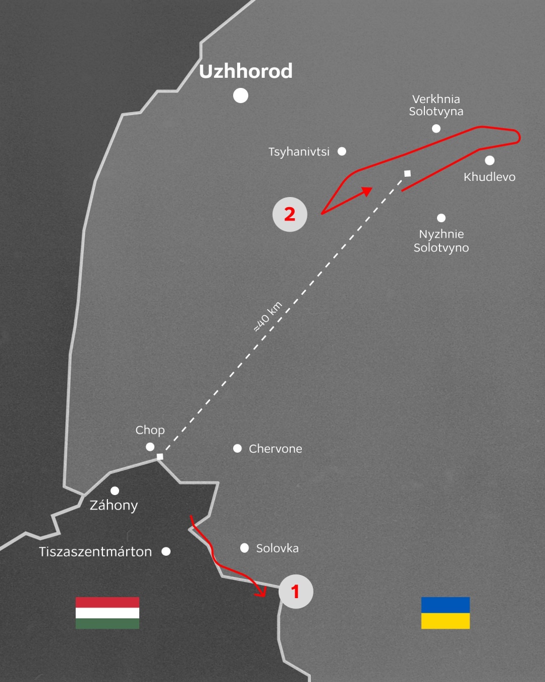
He noted that the Ukrainian Armed Forces "have gathered all the necessary evidence" regarding the incident, adding that Ukraine is still awaiting an explanation from Hungary about why the object entered Ukrainian airspace.

Read also: Zelensky orders military to respond to Hungary's use of reconnaissance drones

Early on September 26, Ukrainian military radar detected twice the passage of an aerial object resembling a drone at different altitudes in the airspace over the Zakarpattia region.

Ukrainian President Volodymyr Zelensky instructed the military to conduct a full investigation into the border violation by Hungarian reconnaissance drones and to respond accordingly should such attempts be repeated.

While citing and using any materials on the Internet, links to the website ukrinform.net not lower than the first paragraph are mandatory. In addition, citing the translated materials of foreign media outlets is possible only if there is a link to the website ukrinform.net and the website of a foreign media outlet. Materials marked as "Advertisement" or with a disclaimer reading "The material has been posted in accordance with Part 3 of Article 9 of the Law of Ukraine "On Advertising" No. 270/96-VR of July 3, 1996 and the Law of Ukraine "On the Media" No. 2849-Х of March 31, 2023 and on the basis of an agreement/invoice.

Online media entity; Media identifier - R40-01421.

© 2015-2025 Ukrinform. All rights reserved.

Extended searchHide extended search
By period:
-