Kakhovka dam blast: 600 sq km of Kherson region flooded

Kakhovka dam blast: 600 sq km of Kherson region flooded

Ukrinform
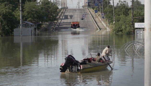
As a result of Russia's blowing up of the Kakhovka dam, 600 square kilometers of Kherson region are under the water, while an average level of flooding is 5.61 meters as of the morning of June 8.

Oleksandr Prokudin, the head of the Kherson Regional Military Administration, wrote this on Telegram, Ukrinform reports.

"In the morning, the average level of flooding ia 5.61 meters. 600 square kilometers of Kherson region are under the water," the report says.

Read also: Blowing up the Kakhovka HPP is an attempt to destroy the South of Ukraine by a “Freshwater Tsunami”

According to Prokudin, 32% of the flooded territories are on the right bank and 68% are on the left bank.

As reported by Ukrinform, in the early hours of June 6, the Russian army blew up the Kakhovka HPP dam. About 16,000 people are in the disaster area on the right bank of Kherson region, evacuation is ongoing. The situation is critical on the temporarily occupied left bank.

While citing and using any materials on the Internet, links to the website ukrinform.net not lower than the first paragraph are mandatory. In addition, citing the translated materials of foreign media outlets is possible only if there is a link to the website ukrinform.net and the website of a foreign media outlet. Materials marked as "Advertisement" or with a disclaimer reading "The material has been posted in accordance with Part 3 of Article 9 of the Law of Ukraine "On Advertising" No. 270/96-VR of July 3, 1996 and the Law of Ukraine "On the Media" No. 2849-Х of March 31, 2023 and on the basis of an agreement/invoice.

© 2015-2024 Ukrinform. All rights reserved.

Website design Studio Laconica

Extended searchHide extended search
By period:
-